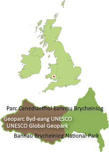
There are excellent general (or ‘topographic’) maps covering the area of the Fforest Fawr Geopark
Several series are published by the Ordnance Survey (Britain’s national mapping agency) and also by Harvey Maps – one of which is in partnership with the British Mountaineering Council.
Ordnance Survey — 1:50,000 scale map
Three sheets from the OS Landranger series give complete coverage of the Geopark. These maps come in magenta and silver covers and cost £6.99 each. Waterproof versions are available at extra cost. OS Landranger maps are ideal for cycling and touring.
- 146 Lampeter & Llandovery / Llanbedr Pont Steffan a Llanymddyfri
- 159 Swansea & Gower / Abertawe & Gwyr
- 160 Brecon Beacons / Bannau Brycheiniog
Ordnance Survey — 1:25,000 scale maps
Three sheets from the OS Explorer series give complete coverage of the Geopark. These maps come in orange and silver covers and cost £7.99 each. With their additional level of detail, OS Explorer maps are ideal for walking and exploring the local area. Waterproof versions — Explorer Map – Active – are available at £13.99.
- No.OL 12: Brecon Beacons National Park – Western Area / Parc Cenedlaethol Bannau Brycheiniog – Ardal Gorllewinol
- No.178: Llanelli & Ammanford / Rhydaman
- No.186: Llandeilo & Brechfa Forest / Fforest Brechfa
British Mountain Maps — ‘Brecon Beacons’
Published by Harvey and the BMC in 2011, this addition to the family of maps covering mountainous areas of Great Britain covers virtually all of the Geopark at a scale of 1:40,000 and with a detailed explanation of the area’s geology on the reverse side, including a relief image coloured to show the different rock types. It is printed on polyethylene for durability.
‘Harvey Superwalker’ — 1:25,000 scale maps
Two sheets cover parts of the Brecon Beacons National Park and are available at £9.99 each or £17.90 for the set of two. Between them they cover all of the upland parts of Fforest Fawr Geopark east of the A4069 Brynaman to Llangadog road. They are ideal for walking – their depiction of vegetation and ground conditions in upland areas can be especially useful.
- Brecon Beacons West (covers the central part of the Geopark)
- Brecon Beacons East (covers the eastern part of the Geopark)
‘Harvey Walker’s Map’ — 1:40,000 scale map
The ‘Brecon Beacons Walkers Map’ covers much the same territory as the two sheets at 1:25,000 scale. It is available at £5.75 and is waterproof.
‘Brecon Beacons West’ A-Z Adventure Atlas – 1:25,000 scale map
One of a series, the A5-sized booklet titled ‘Brecon Beacons West’ covers the entire Geopark in 70 pages of up-to-date OS 1:25,000 mapping. It is available at £7.95


