Getting here is easy!
Take the train!
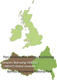
The Heart of Wales Rail Line runs along the Towy Valley. The Geopark is within easy reach of the stations on this line at Llandovery, Llangadog, Llandeilo and Ammanford. There are stations too at Merthyr Tydfil at the southeast corner of the area whilst Abergavenny to the east lies on the Newport to Hereford line. Consult National Rail Enquiries for details of services.
. . or the bus!
There are several bus services which run through the Geopark and provide an excellent opportunity for walkers to get to know the area better. Consult Traveline Cymru for more information.
The T4 service runs up and down the A470 through Fforest Fawr Geopark and the wider Bannau Brycheiniog National Park linking Brecon with Cardiff and Merthyr Tydfil to the south and Builth Wells and Newtown to the north. The T6 service runs from Swansea to Brecon up the Swansea Valley via Neath and Ystradgynlais.
Craig-y-nos Country Park (T6), Garwnant (T4) and Storey Arms (T4) are amongst the attractions served by these buses.
A bike bus runs from Cardiff to Brecon on Summer Sundays and Bank Holidays. For more information visit the Cardiff Bus website.
You could come by car.
The A40 runs from Abergavenny to Brecon, then along the northern edge of the Geopark to Llandovery and Llandeilo. The A465 ‘Heads of the Valleys Road’ runs along the southern edge of the Geopark from Merthyr Tydfil to the Vale of Neath. The western part of the Geopark is reached from the end of the M4 within 30 minutes.
Electric car? Check out the charging points available here.
. . . but why not cycle?
The National Cycle Network is expanding all the time and there are several routes which link to Fforest Fawr UNESCO Global Geopark. Do yourself and the environment a power of good – bike it!


