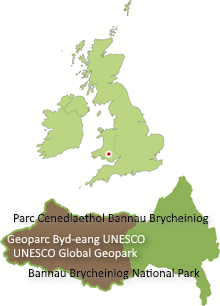
Planning Solutions Consulting are currently assisting Bannau Brycheiniog (Brecon Beacons) National Park Authority to determine how the proposals to expand the Geopark within Neath Port Talbot county borough might be taken forward in conversation with local interests. If you have an interest please contact the Geopark Development Officer in the first instance.
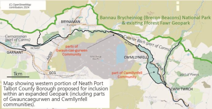
The proposals (as at 18 October 2024) envisage portions of the following communities being included within an expanded Geopark:
- Gwaun-cae-gurwen
- Cwmllynfell
- Onllwyn
- Glynneath
- Blaengwrach
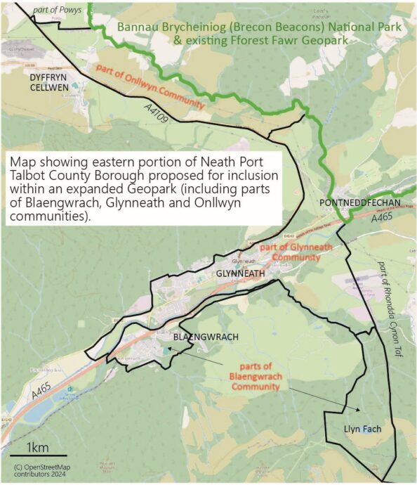
In the area between Ystradgynlais and Glanamman, a belt of country has been proposed for inclusion in an expanded Geopark but it is split in complex fashion between Powys, Carmarthenshire and Neath Port Talbot. The small areas that are within NPT would only be considered for inclusion if the intervening sections of Cwarter Bach and Cwmamman communities (both in Carmarthenshire) were also taken into the expanded area, otherwise the NPT slivers of territory would be ‘islands’ detached from the main part of the Geopark.
Features of interest to the Geopark within the NPT area include (but are not necessarily restricted to):
- National Cycle Network route 437
- Other public access e.g. rights of way network, access land
- Nature reserves and other land protected for its wildlife and habitats
- Roman remains north of Banwen
- Industrial remains in lower Nedd Fechan gorge
- Industrial transport infrastructure in Glynneath area e.g. Neath Canal and linking tramroads
- Venallt Ironworks
- Cwm Gwrelych geological SSSI
- Llyn Fach (glacial cirque in coalfield scarp)
Each of the above contributes something to the natural and cultural heritage of this area. However the mention of any site in this list is without prejudice to landowners and others with an interest of any sort. Inclusion within an expanded Geopark does not bring any additional public access (or controls) to any particular site except where that is agreed by all interested parties.
