RESEARCH SEMINAR
2011
“Fforest Fawr – Developing the Geopark’s Research Potential”
Abstracts
Supported by:
British Geological Survey, Forestry Commission Wales, Brecon Beacons National Park Authority
Welcome to the 2011 Fforest Fawr Geopark Research Seminar at Forestry Commission Wales’ Garwnant Visitor Centre
I would like to take this opportunity to welcome you to this, the second Annual Research Seminar hosted under the aegis of the Fforest Fawr European Geopark. I particularly wish to thank all our speakers for their contributions and for highlighting the excellent research which has come to a conclusion since last year, as well as exploring new research areas for the future.
As the Geopark looks towards its second European Geoparks Network revalidation next year, it is the concept of advancing the scientific research potential of the area which is the theme of this year’s seminar. With increasing demands on time and limited resources, the necessity to produce targeted applied research which assists land management, that supports policy makers and meets educational priorities has never been greater, whilst the detailed examination of sites which may provide answers to some of the environmental challenges of today and the near future remain as important as ever. Consideration on how to balance competing priorities may well be a topic for the Discussion Session at the end of the meeting.
The ongoing commitment and support of the Brecon Beacons National Park Authority and the National Park Members to the Geopark concept remains as important as ever, and work is now underway, under the aegis of EGN, to explore how the Geopark concept is making a difference in the varying and diverse territories of the network, and sustainable development may well be a theme in future seminars.
Geopark, however, is about fostering partnerships and the continued support and commitment of public bodies, academic institutions and private enterprises to the benefit of local communities and visitors, and the continuing support of the British Geological Survey and Forestry Commission Wales for this event is appreciated.
Convenor
Dr Adrian Humpage
British Geological Survey,Cardiff
RESEARCH SEMINAR 2011
“Fforest Fawr – Developing the Geopark’s Research Potential”
At Forestry Commission Wales’ Garwnant Visitor Centre, Cwm Taf
FREE ADMISSION
Programme of Presentations
9.30 Arrive and Coffee
10.00 Welcome and Introduction
10.15 The Fforest Fawr Geopark – an area of research potential
Alan Bowring, Geopark Development Officer, Brecon Beacons National Park Authority
10.45 Archaeological Investigations within Fforest Fawr Geopark: recent examples and future opportunities
Louise Austin, Dyfed Archaeological Trust
11.15 Regionally Important Geological Sites in the Fforest Fawr Geopark – networks and distribution
Dr Adrian Humpage, British Geological Survey, Cardiff
11.45 Modelling the Brownstones Formation of South Wales– Part 2
Dr John Davies and Rhian Kendall
12.15 Developing a Local Geodiversity Action Plan (LGAP)
Dr Adrian Humpage, British Geological Survey, Cardiff
12.45 – 1.45 Lunch*
1.45 A sedimentological and palynological approach to the determination of the origin of the depositional land form at Cwm Llwch, Brecon Beacons, South Wales
Francesca Ellis, University of Gloucestershire
2.15 Field Spectroscopy on The Black Mountain
Shaun Lewis and Judith Harvey, Brecon Beacons National Park Authority
2.45 The use of GIS, remote sensing and fire simulation modelling for assessing the damage from wildfires on moorland on the Brecon Beacons
John Phillips, Aberystwyth University
3.15 – 3.30 Tea
3.30 Understanding Late Quaternary Marginal Glaciation in Britain – Investigating the Interrelation between Climate, Topography and Glacier Dynamics
Eleri Harris, Swansea University
4.00 – 4.30 Discussion
Poster presentations are invited for display during the seminar
For further information, contact Dr Adrian Humpage Tel: 029 2052 1962 Email: ajhu@bgs.ac.uk
* Lunch is not provided but may be taken at “Just Perfect” restaurant at Garwnant
Abstracts: Oral Presentations
The Fforest Fawr Geopark – an area of research potential
Alan Bowring
Geopark Development Officer, Brecon Beacons National Park Authority, Plas-y-ffynnon,Cambrian Way,Brecon,LD3 7HP.
Alan.Bowring@breconbeacons.org
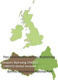
A presentation outlining the extent of the Fforest Fawr Geopark, its geology, its attractions and the scope for conducting research in environmental science, geotourism opportunities and other topics.
Formation of the solid rocks underlying the area spans a period of nearly 200 million years from 480mya to 300mya; faulted and folded Ordovician and Silurian sandstones, mudstones and siltstones characterise the northwest of the Geopark whilst a thick Old Red Sandstone sequence dominates the east and centre. To the south are successive broken cuestas of Carboniferous Limestone, Twrch Sandstone and Farewell Rock with intervening strike valleys underlain by mudstones.
The Quaternary ice ages have left an erosional and depositional legacy and human presence in the landscape over the last 8000 years has left an increasing mark through agriculture, industry, forestry and tourism.
The Geopark seeks to tell all of the se stories in an engaging and holistic way, making connections between the different disciplines. It is one of 9 such designated areas to do so in the British Isles, one of 48 across Europe (European Geoparks Network) and of around 88 worldwide (Global Geoparks Network).
Archaeological Investigations within Fforest Fawr Geopark: recent examples and future opportunities
Louise Austin
Head of Heritage Management, Dyfed Archaeological Trust, The Shire Hall, Carmarthen Street, Llandeilo, Carmarthenshire, SA19 6AF.
l.austin@dyfedarchaeology.org.uk
Over recent years Dyfed Archaeological Trust have undertaken a number of investigations of archaeological sites within the Geopark. This presentation will cover some of the results and include the excavation of a Bronze Age barrow on the summit of Fan Foel, Mynydd Du and detailed survey of the Roman fortlet at Waun Ddu, Mynydd Myddfai.
A brief update will be presented on significant work undertaken by other archaeological organisations in the area and will include the on-going analysis of the archaeological investigations associated with the gas pipeline across Mynydd Myddfai.
Future research opportunities will also be explored where archaeology, geology and biodiversity come together at the historic lime working site of Herbert’s Quarry on the Black Mountain.
Regionally Important Geological Sites in the Fforest Fawr Geopark – networks and distribution
Dr Adrian Humpage
British Geological Survey,ColumbusHouse, Greenmeadow Springs, Tongwynlais,CardiffCF15 7NE.
The three year South Wales RIGS (Regionally Important Geodiversity Sites) audit, funded by the Welsh-Government administered Aggregates Levy Sustainability Fund for Wales (ALSFW) is now in its final phases, and for the first time, a comprehensive listing of non-scheduled geological sites will be available to Local Authorities for consideration within their planning policies, as highlighted in Welsh Government Technical Advice Note (TAN) 5.
Across the Fforest Fawr Geopark, a suite of RIGS have been identified and grouped into a series of geological “Networks”, which describes the scientific rationale behind their respective designation and the relationships between the individual RIGS sites, and between RIGS and scheduled sites such as Sites of Special Scientific Interest. The completion of the audit thus creates opportunities for future interpretation and scientific study within the Geopark within the context of the widerSouth Walesregion.
Modelling the Brownstones Formation of South Wales– Part 2
Dr John Davies1 and Rhian Kendall2
1 Welsh Stone Forum, c/o Dr Jana Horak, Department of Geology, National Museum of Wales, Cathays Park, Cardiff CF10 3YE.
2 British Geological Survey,Columbus House, Greenmeadow Springs, Tongwynlais,Cardiff CF15 7NE.
The detailed stratigraphy and palaeogeography of the Brownstones Formation is very poorly understood. Though the area occupied by the formation covers a large part of southWalesand the adjacent West Midlands ofEngland, it has not been possible, as yet, to produce a model for the deposition of the Brownstones sequence. New computer software available to BGS has made it possible to construct such a model, based both on data collected over the years and present within BGS archives and on recent field data collection. The techniques utilised are relatively simple, but the results should give us a new picture of a palaeogeography of a major part of the Geopark area during the Devonian.
Developing a Local Geodiversity Action Plan (LGAP)
Dr Adrian Humpage
British Geological Survey,ColumbusHouse, Greenmeadow Springs, Tongwynlais,CardiffCF15 7NE.
Local Geodiversity Action Plans (LGAPs) provide a mechanism to embed study, interpretation and management of a region’s geological heritage, be it based on individual sites or landscape assessments, within a framework for policy makers and local communities, and identify opportunities for increased protection and sustainable economic development ensuing.
Earth sciences impacts upon almost every aspect of a region’s character, from the position of settlements to land use practices, from lake basins to excavated quarries. Geodiversity, thus plays a fundamental role within the wider environment, and policies which provide for better protection and management of geodiversity, also contribute to our understanding of the vital links between wildlife, cultural and historical aspects of the environment in which we live.
Many of these aspects are well established or underway with Fforest Fawr Geopark, but other elements may require additional resources or consideration before full integration can be achieved.
A sedimentological and palynological approach to the determination of the origin of the depositional land form at Cwm Llwch, Brecon Beacons, South Wales
Francesca Ellis
UniversityofGloucestershire,Swindon Road,Cheltenham, GL50 4HZ.
An investigation centred around the determination of the origin of the deposition ridge feature that encompasses Llyn Cwm Llwch in the Brecon Beacons. Previous literature concerning the site alluded to there being some ambiguity as to its origin mainly; whether it was deposited by a glacier and if so, whether it was during the Late Glacial Maximum or the Loch Lomond Stadial.
A sediment core was taken from the periphery of the lake. The sediment sequence presented in the core was compared to other sites of known origin in the Brecon Beacons. Samples from the core were taken for palynological analysis (pollen analysis) from which the story of ecological succession at the site was obtained. The changes in pollen throughout core were classed into ‘biozones’ and compared with similar ‘biozones’ created for other sites of known origin in the Brecon Beacons and Snowdonia.
Comparison of these two lines of evidence indicated that the ridge feature encompassing Cwm Llwch was deposited as a result of a small cirque glacier that formed during the Loch Lomond Stadial.
Field Spectroscopy on The Black Mountain
Shaun Lewis and Judith Harvey
Brecon Beacons National Park Authority, Plas-y-ffynnon, Cambrian Way, Brecon, LD3 7HP. Shaun.Lewis@breconbeacons.org
The use of GIS, remote sensing and fire simulation modelling for assessing the damage from wildfires on moorland on the Brecon Beacons
John Phillips*
AberystwythUniversity
*Corresponding Address:PowysCountyCouncil
The damage from a wildfire on moorland in the Mynydd Isaf region of the Brecon Beacons National Park (BBNP) in the spring of 2011 was looked at using GIS, remote sensing and fire simulation technology. Wildfire risk maps were produced in ArcGIS, and the FARSITE and FlamMap fire simulators were used to model the spread and intensity of the fire. Information on the extent of the fire damage was collected using a GPS from site visits conducted in June 2011. The habitats were first classified in eCognition (remote sensing software) and then, along with other datasets including aspect, slope and access routes, were used to produce wildfire risk maps in ArcGIS. These showed that exposed peat on blanket bog and bilberry-dominated heaths were the habitats with the highest risk, particular where they occur on flatter, north to north-west facing slopes close to access routes, e.g. roads. FARSITE was used to model the actual spread of the wildfires, using spatial and temporal information on topography, fuels, and weather. The results of this were compared to observations of the spread of the fires by staff of the BBNP, which showed a favourable comparison. FlamMap used the same information as FARSITE, but was able to show the predicted rate of spread and fire intensity over the whole study area. The results showed that the spread rate and fire intensity were far greater on mature heather heaths than other habitats. The results of both the wildfire risk mapping and fire simulation modelling have shown that GIS, remote sensing and fire simulation technology can aid in the planning of fire prevention measures and allow firefighters to prioritise areas they need to focus on to tackle wildfires before they get out of control.
Understanding Late Quaternary Marginal Glaciation in Britain – Investigating the Interrelation between Climate, Topography and Glacier Dynamics
Eleri Harris
Department of Geography,SwanseaUniversity,Swansea,SA2 8PP.
s.e.harris.604423@swansea.ac.uk
This research project aims to investigate, through a range of techniques, the existence of highland marginal glaciation both alongside the British Irish Ice Sheet (BIIS) during the Last Glacial Maximum (LGM) and lateglacial. Such smaller scale glaciation outside of ice caps has been largely overlooked in research to date, particularly so inWales. Sensitivity to climatic and topographic controls will be explored in addition to glacier dynamics.
Appreciation of past glacier extent and dynamics is fundamental in the investigation of glacial climatic sensitivities, particularly for short-lived climatic events such as the Loch Lomond Stadial (LLS). Glacial reconstruction will therefore be undertaken of selected sites across highland areas, including within the Brecon Beacons and Fforest Fawr Geopark, to confine the extent of local glaciations and enable calculation of palaeoglaciological and palaeoclimatic variables e.g. equilibrium-line altitude and precipitation. Marginal glaciers in these areas have previously been thought to represent the LLS only however this will be further investigated, also with consideration of earlier lateglacial origin. Contemporary glaciated environments in southern Norway, where typical cirque glaciation constrained to cirque basins is commonly found, will be explored to provide a modern analogue for such marginal glaciation likely to have occurred in Wales.
A multi proxy approach to reconstruction will be adopted both of the palaeo and modern environments, with fundamental analyses derived from geomorphological and sedimentological data to build a morpho- and litho-stratigraphy and create a glacial landsystem for each study area. Geomorphological techniques will include detailed field mapping of glacial and associated landforms in addition to the review of remotely sensed images. Traditional field and lab based sedimentological techniques of exposures will then be applied as supporting evidence of landform origin. Basic glaciological modelling, as outlined in recent publications, will both test and provide additional rigour to the reconstructions.
It is anticipated that this study will provide new evidence of marginal glaciation in Britain during the LGM and lateglacial and seeks to increase understanding of climatic and topographical sensitivities of these ice masses in highland areas ofWalesduring this period. The findings are likely to inform future research and interpretation of the last British Irish Ice Sheet.


